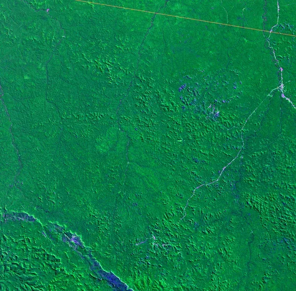
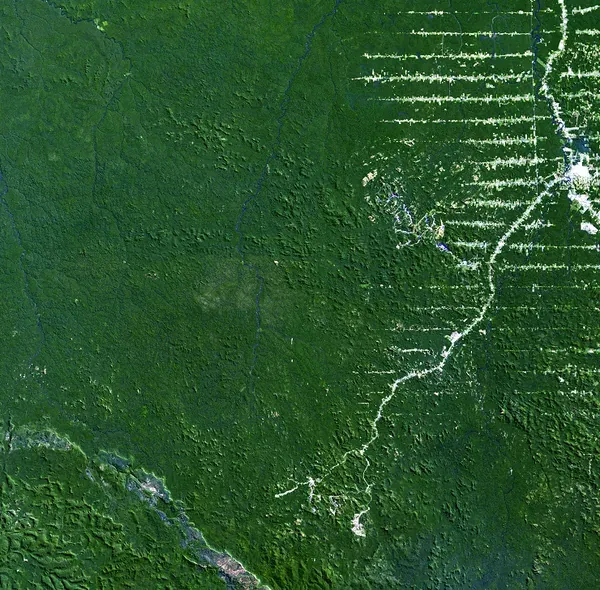
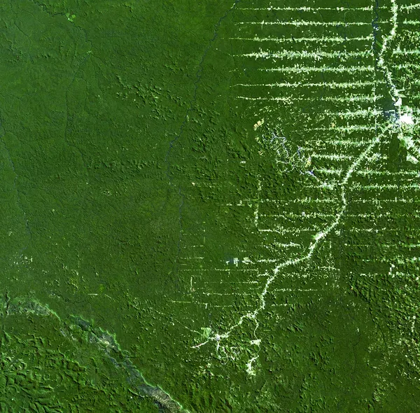
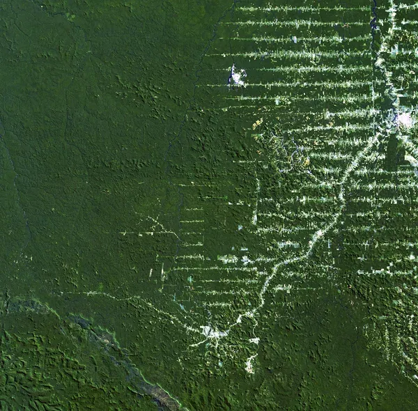
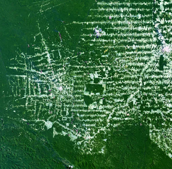
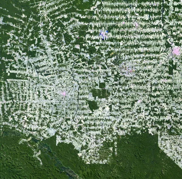
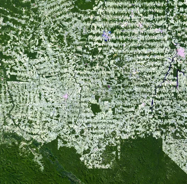
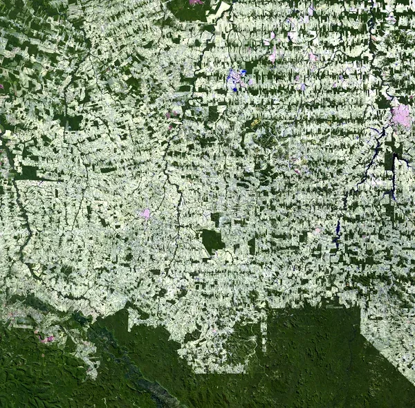
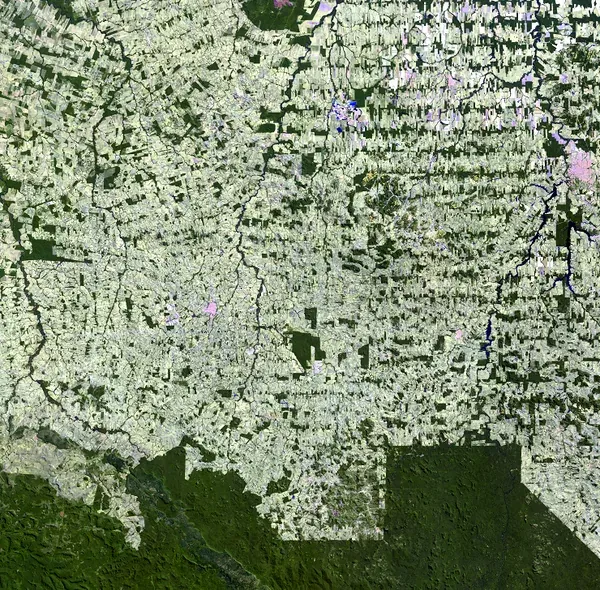
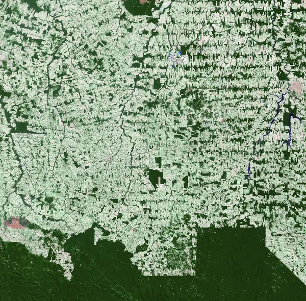
Clearing tropical rainforest for cattle pasture and cropland reshapes the land
quickly, and few places show that better than the Brazilian state of Rondônia.
Brazil holds roughly 30 percent, or about 3,562,800 sq km (1,375,600 sq mi), of the world's
remaining tropical forest. From 1978 to 1988 the country lost an estimated
15,000 sq km (5,790 sq mi) of forest a year on average. By 2003, about 67,764 sq km (26,164 sq mi) of Rondônia's rainforest
had already been cleared—more land than the entire U.S. state of West
Virginia.
The clearing tends to follow the same pattern each time: Cutting starts along a
new road and then branches outward in narrow rows, forming the "fishbone" shape visible on the eastern side of the 1984 image in this slideshow.
These images trace that change across roughly five decades, using Landsat imagery from most years between 1975 and 2024. What they can't show is everything
happening out of frame—the loss of wildlife habitat and the wider effect on
local and global climate as the forest disappears.
Rondônia, by the numbers
Table with two columns, year and area cleared, and four rows. It shows the total estimated area of rainforest cleared in Rondônia growing steadily, from 4,200 square kilometers in 1978 to 67,764 square kilometers in 2003.
Estimated area of rainforest cleared in Rondônia over time
| year |
area cleared |
| 1978 | 4,200 sq km (1,620 sq mi) |
|---|
| 1988 | 30,000 sq km (11,580 sq mi) |
|---|
| 1998 | 53,300 sq km (20,580 sq mi) |
|---|
| 2003 | 67,764 sq km (26,164 sq mi) |
|---|
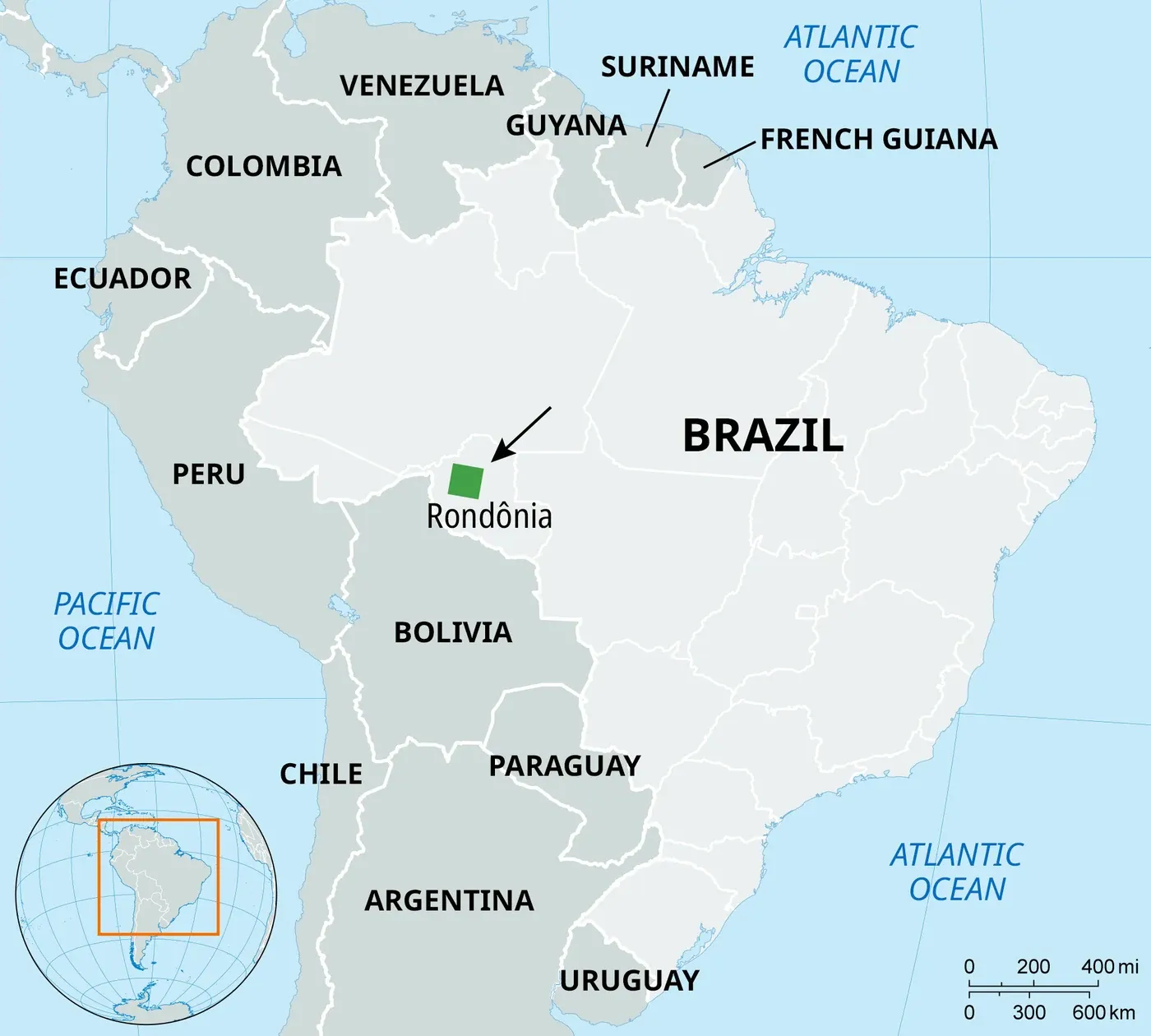
Rondônia is a relatively small state—about 237,800 sq km (91,800 sq mi), which is roughly 5 percent
of Brazil's nine-state "Legal Amazon" region (about 5,014,000 sq km, or 1,936,000 sq mi) and under 3 percent
of Brazil as a whole. But the clearing has been so intense that by 2003 the
67,764 sq km (26,164 sq mi) already cut down came to nearly 30 percent of the entire state—one of
the highest deforestation shares of any Amazon state, concentrated in a
comparatively small footprint.
Brazil's wider deforestation trend
Rondônia is one piece of a much larger pattern. Brazil's National Institute for
Space Research (INPE) has tracked clear-cutting across the entire nine-state
Legal Amazon every year since 1988 through its PRODES satellite-monitoring
program. Rates have swung considerably over the decades—rising through the
early 2000s, falling sharply in the late 2000s and early 2010s, climbing again
in the late 2010s, and dropping again more recently.
Table with two columns, year and area cleared, and four rows. It shows the area cleared in a single year across the whole Legal Amazon: 21,050 square kilometers in 1988, a drop to 17,383 in 1998, a rise to 25,396 in 2003, and a much lower 6,518 in 2024.
Annual deforestation rate in the Brazilian Legal Amazon (all nine states)
| year |
area cleared |
| 1988 | 21,050 sq km (8,130 sq mi) |
|---|
| 1998 | 17,383 sq km (6,712 sq mi) |
|---|
| 2003 | 25,396 sq km (9,805 sq mi) |
|---|
| 2024 | 6,518 sq km (2,517 sq mi) |
|---|
Sources: Background and figures adapted from
USGS EROS Earthshots—Rondônia, Brazil.
National deforestation figures: Brazil's National Institute for Space Research
(INPE),
PRODES/TerraBrasilis. Area figures:
Brazilian Institute of Geography and Statistics (IBGE).
Credits: USGS Earth Resources Observation and Science Center, Encyclopædia Britannica, Inc.